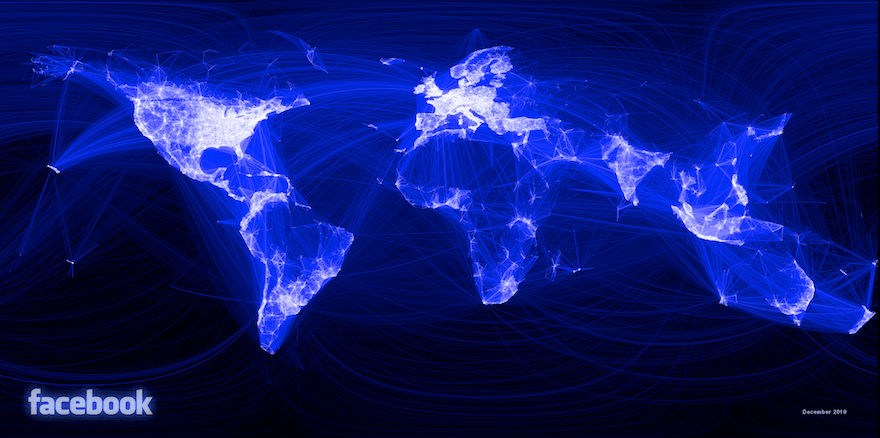
This world map is drawn using Facebook connections only. It was created by Paul Butler using connections between 10 million Facebook friends. The result is a remarkably good approximation of most continents and even the borders of some countries appear. China and Russia, however, seem to be missing in the Facebook empire.
tank101
How would the world looking from the point of view of a chinese social network? should be quite intersting to compare..
Posted on
Koert van Mensvoort
@steve: So? Of course, somewhere the connection with geographical space has to be made. The interesting mapping part is that some regions become very visible, whereas others less so.
Posted on
Steve
"Then I merged the data with the longitude and latitude of each city."
Posted on